This is a “Sidetracks” feature written for the Trolley Project website.
For a basic understanding of the trolleys that served SW Portland, please go to: dialectrix.com/trolley.
This is a “Sidetracks” feature written for the Trolley Project website.
For a basic understanding of the trolleys that served SW Portland, please go to: dialectrix.com/trolley.
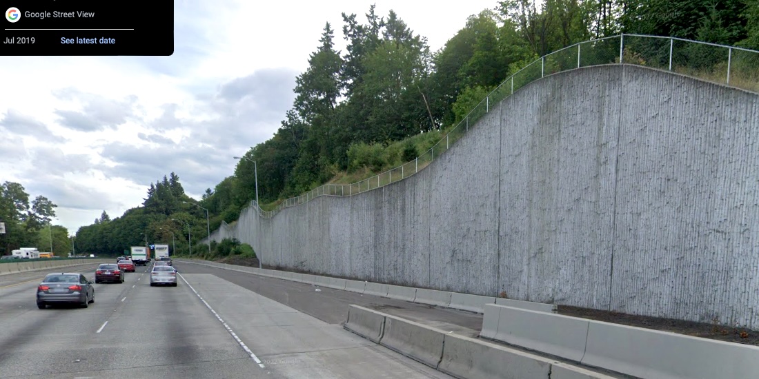
As we wrote on the Fulton Park Line page, the Metropolitan Railway route was difficult to maintain because the hillside was not stable. After the FP Line was abandoned, the Oregon Electric folks came along in 1907 and re-used that 'right of way' or natural geographic trajectory. Mud slides plagued the new line, too, so a massive retaining wall was put in place in 1913, persisting long after the Oregon Electric ceased operation. It was even left in place when I-5 was built along that corridor starting in 1957.
Most drivers on I-5 didn’t realize the wall was there, hidden as it was under decades of ivy and moss. But when it came time for the Oregon Department of Transportation (ODOT) to upgrade I-5’s Iowa Street viaduct in 2010, they uncovered the nearby wall for all to see, next to the southbound lanes around Milepost 297.5. Unfortunately, they then had to remove the wall to make way for a temporary construction bypass lane.

To ODOT’s credit, they knew the historic value of the wall and saved two blocks of concrete with the 1913 construction date inscribed on them. One date block went to the Oregon Electric Railway Museum at Brooks, Oregon. The other was held at the ODOT facility in south Portland, to be used in Tigard along their new downtown trail. But when it was time to install the block it was nowhere to be found...a piece of history lost and an unsolved mystery.

We have personally been assured by the Oregon Electric Railway Historical Society that the remaining date block is indeed on the property in a protected location awaiting installation on the museum grounds.
The Trainmaster describes this retaining wall and construction project. Trainmaster newsletter, October 2010, pages 10-11 only [836 KB PDF]. The newsletter also appears in our Resource Collection page.
We can thank photographer Fred Kiser for documenting the construction and early days of the Oregon Electric (OE), including mudslides along the way. One particular series of slide photos in the vicinity of the later retaining wall provides clues as to how the OE dealt with such disasters. What we believe we’re seeing in this photo is the hillside having sloughed off onto the original track, remains of which are under the mud, with a new track laid just to the east. The Metropolitan had similar problems in the same area twenty years before. In both cases, such repairs and workarounds were made quickly to minimize interruptions in service.
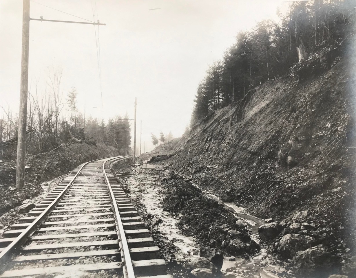
In the photo below, taken after the OE was double-tracked, the bank on the left may be the same one that was cut back to make room for the “passing track” after the slide. The retaining wall is in place, with one of the date blocks visible at the far end.

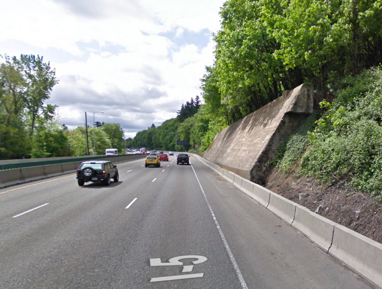
While this railbed became much wider with double-tracking, the hillside was further, and even more dramatically, sculpted to make room for I-5.
This is how the section of I-5 near the OE wall looks today. Clearly, ODOT had learned from the earlier slides, and when they cut into that hillside again in 2010 they weren’t taking any chances.
Craig, on "Forgotten Oregon" Facebook group, says the new wall was built by Wildish from Eugene. So there you have it.
Whereas we've worked hard to gather the information presented here; and we've added value with our original writing; we are placing this page under a Creative Commons Attribution 4.0 International license [CC BY-NC-SA 4.0].
All we ask is notification and attribution of any re-use. Please send notifications to trolley @ Dialectrix.com — Thank You!
The Trolley Project, Portland, Oregon.