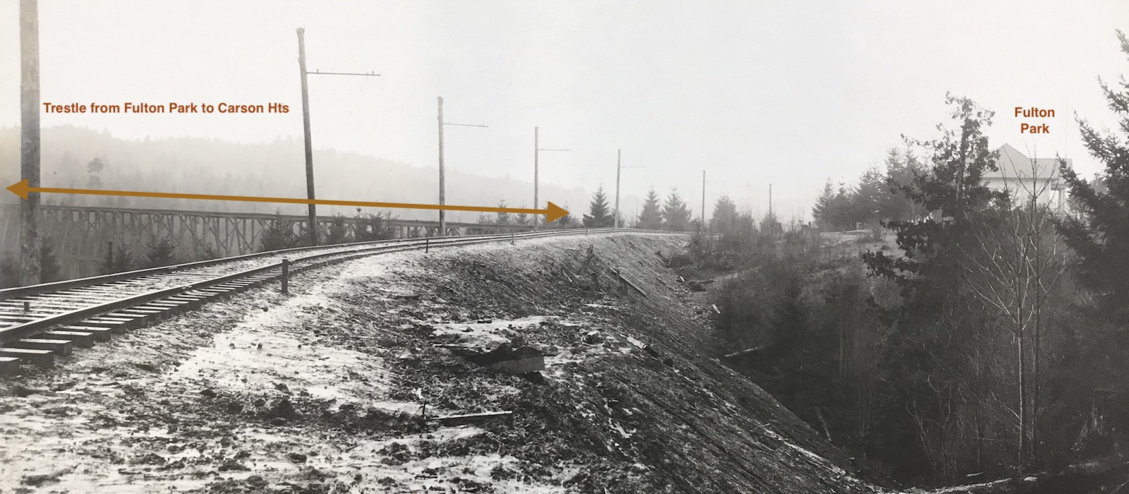
The Trestle over Stephens Creek
Intro italic text...
The FP Line needed a trestle to get from Fulton Park across one of Stephens Creek's ravines in order to continue on at a comparable elevation. No record or trace of this trestle has (yet) been found. I-5 and a SC sewer project likely obliterated any remnants.
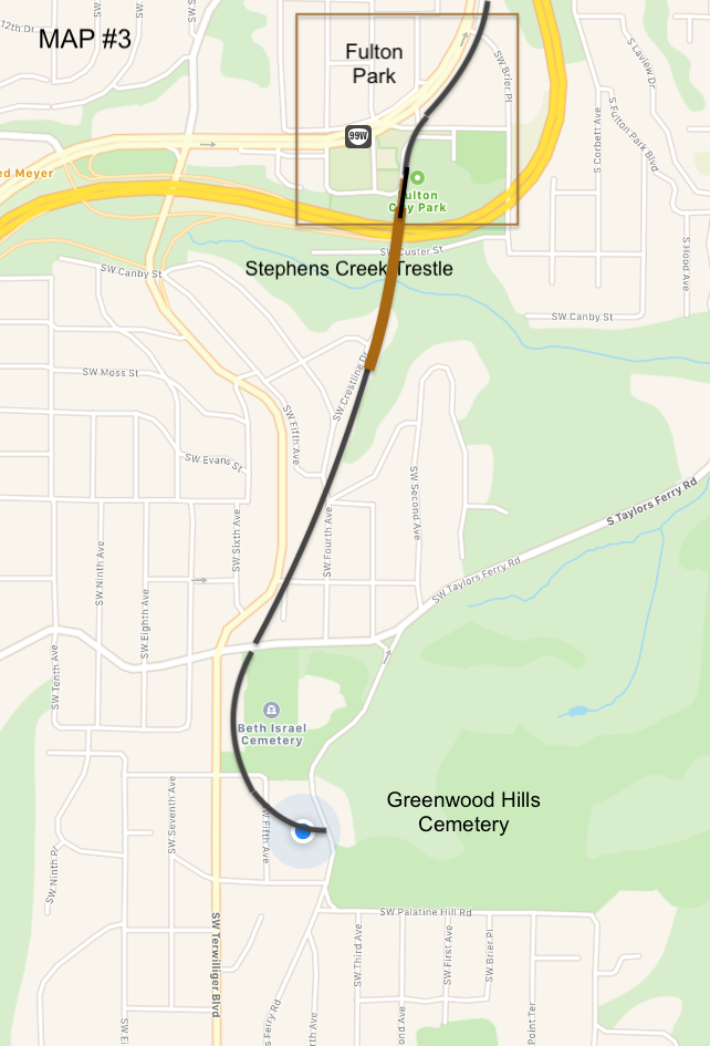
Map #3 shows the FP Line landing at the end of today's SW Crestline Drive, which is situated along the top of a natural arm of land between two drainages. It was in a good position and alignment to receive the trolley line tracks from Fulton Park, given a trestle. This is our best guess, based on the FP Line route shown on the 1894 Portland Paving map.
In an April 4th, 1895 newspaper account referred to "trestles", PLURAL:
A resolution appropriating $75 to bulld a sidewalk on trestles between Carson Heights and Fulton Park was adopted.
Other newspaper accounts refer to 900 and 400 foot trestles. We have no idea where the 400 foot trestle would have been.